Ficheiro:Kediet Ijill satellite photo.png
Tamaño desta vista previa: 800 × 573 píxeles. Outras resolucións: 320 × 229 píxeles | 640 × 458 píxeles | 966 × 692 píxeles.
Ficheiro orixinal (966 × 692 píxeles; tamaño do ficheiro: 1,49 MB; tipo MIME: image/png)
| Este ficheiro procede de Wikimedia Commons. A continuación móstrase a información da súa páxina de descrición. Commons é un repositorio libre de ficheiros multimedia. Pode contribuír alí cargando as súas imaxes. |
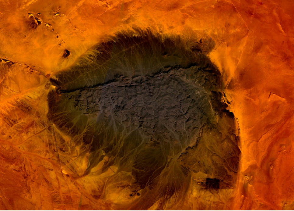
| Descrición | Mt. Kediet Ijill, Mauritania - seen from space | |||
| Data | screenshot taken on July 9th, 2007 | |||
| Orixe | screenshot from World Wind program | |||
| Autoría | NASA | |||
| Licenza (Reuso deste ficheiro) |
|

Historial do ficheiro
Prema nunha data/hora para ver o ficheiro tal e como estaba nese momento.
| Data/Hora | Miniatura | Dimensións | Usuario | Comentario | |
|---|---|---|---|---|---|
| actual | 9 de xullo de 2007 ás 14:22 | | 966 × 692 (1,49 MB) | Botev | {{Information |Description=Mt. Kediet Ijill, Mauritania - seen from space |Source=screenshot from World Wind program |Date=screenshot taken on July 9th, 2007 |Author=NASA |Permission={{PD-WorldWind}} |other_versions= }} [[Category:Satellite images of Mau |
Uso do ficheiro
A seguinte páxina usa este ficheiro:
Uso global do ficheiro
Os seguintes wikis empregan esta imaxe:
- Uso en ar.wikipedia.org
- Uso en arz.wikipedia.org
- Uso en ceb.wikipedia.org
- Uso en cs.wikipedia.org
- Uso en de.wikipedia.org
- Uso en en.wikipedia.org
- Uso en eo.wikipedia.org
- Uso en es.wikipedia.org
- Uso en fa.wikipedia.org
- Uso en fr.wikipedia.org
- Uso en hu.wikipedia.org
- Uso en it.wikipedia.org
- Uso en ja.wikipedia.org
- Uso en lt.wikipedia.org
- Uso en mt.wikipedia.org
- Uso en pl.wikipedia.org
- Uso en pt.wikipedia.org
- Uso en ru.wikipedia.org
- Uso en sh.wikipedia.org
- Uso en sv.wikipedia.org
- Uso en uk.wikipedia.org
- Uso en vec.wikipedia.org
- Uso en www.wikidata.org