Ficheiro:Un-myanmar.png
Ficheiro orixinal (2.366 × 3.092 píxeles; tamaño do ficheiro: 1,83 MB; tipo MIME: image/png)
| Este ficheiro procede de Wikimedia Commons. A continuación móstrase a información da súa páxina de descrición. Commons é un repositorio libre de ficheiros multimedia. Pode contribuír alí cargando as súas imaxes. |
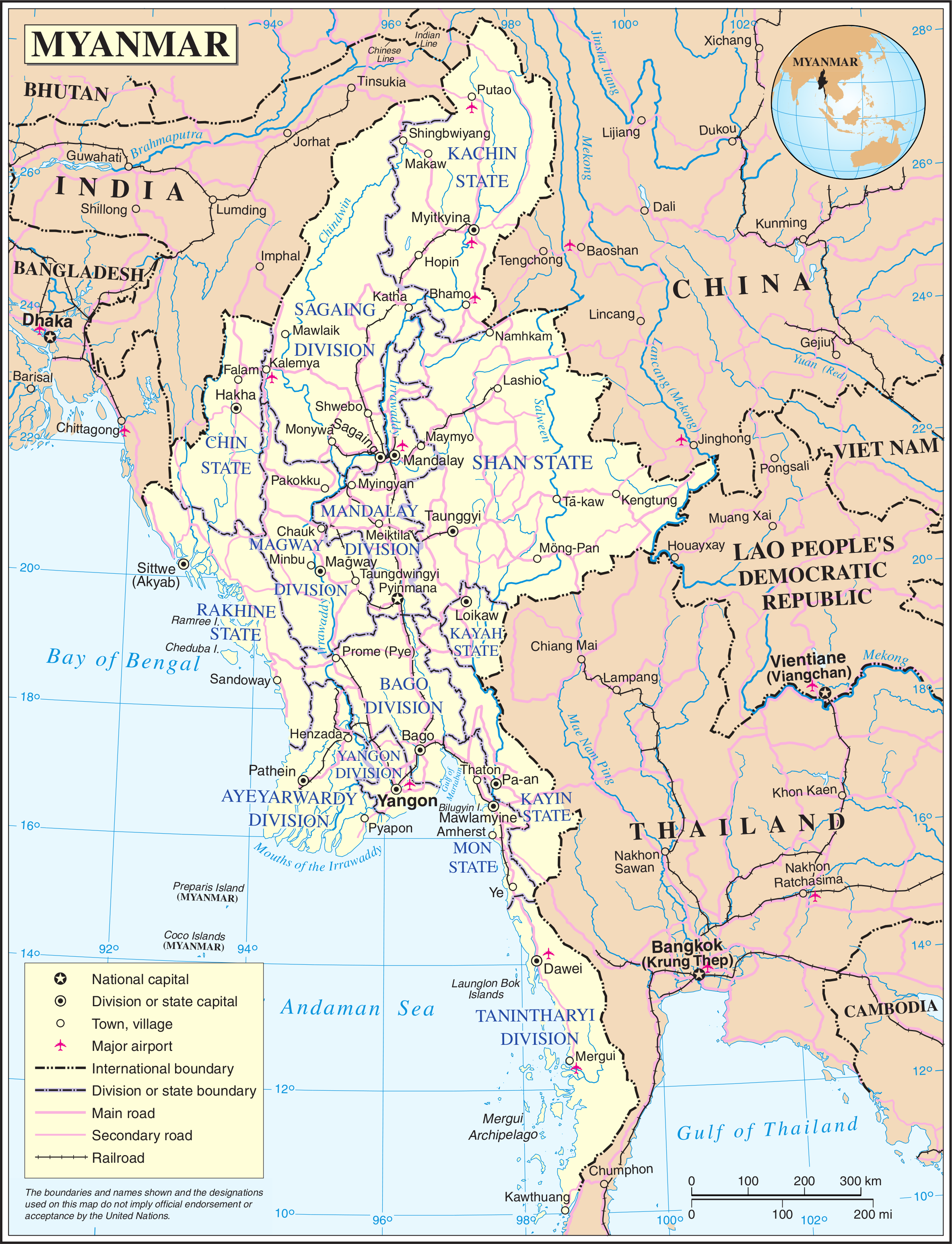
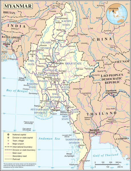
Map of Myanmar. Based on the UN map, but the location capital has been updated by me (the original uploader).
| This image is a map derived from a United Nations map.
Unless stated otherwise, UN maps are to be considered in the public domain. This applies worldwide. UN maps are, in principle, open source material and you can use them in your work or for making your own map. UN requests however that you delete the UN name, logo and reference number upon any modification to the map. Content of your map will be your responsibility. You can state in your publication, if you wish, something like: based on UN map … (map name, map number, revision number and date). See: Geospatial Information Section. And: Geospatial, location data for a better world. |
 |
Historial do ficheiro
Prema nunha data/hora para ver o ficheiro tal e como estaba nese momento.
| Data/Hora | Miniatura | Dimensións | Usuario | Comentario | |
|---|---|---|---|---|---|
| actual | 13 de maio de 2008 ás 21:11 | | 2.366 × 3.092 (1,83 MB) | Mahahahaneapneap | Compressed |
| 24 de outubro de 2007 ás 01:36 |  | 2.366 × 3.092 (2,42 MB) | Jeroen | Map of Myanmar. Based on the UN map, but the location capital has been updated by me (the original uploader). {{UN map}} Category:Maps of Myanmar |
Uso do ficheiro
A seguinte páxina usa este ficheiro:
Uso global do ficheiro
Os seguintes wikis empregan esta imaxe:
- Uso en az.wikipedia.org
- Uso en bn.wikipedia.org
- Uso en en.wikipedia.org
- Uso en fi.wikipedia.org
- Uso en fr.wikipedia.org
- Uso en kg.wikipedia.org
- Uso en pl.wiktionary.org
- Uso en shn.wikipedia.org
- Uso en simple.wikipedia.org
- Uso en si.wikipedia.org
- Uso en sl.wikipedia.org
- Uso en uk.wikipedia.org
- Uso en zh.wikipedia.org