Ficheiro:Un-bahrain.png

Ficheiro orixinal (2.104 × 2.821 píxeles; tamaño do ficheiro: 863 kB; tipo MIME: image/png)
| Este ficheiro procede de Wikimedia Commons. A continuación móstrase a información da súa páxina de descrición. Commons é un repositorio libre de ficheiros multimedia. Pode contribuír alí cargando as súas imaxes. |
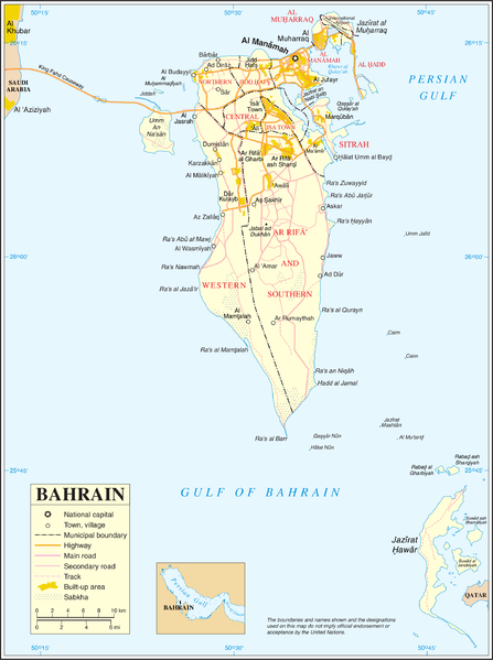
| This image is a map derived from a United Nations map.
Unless stated otherwise, UN maps are to be considered in the public domain. This applies worldwide. UN maps are, in principle, open source material and you can use them in your work or for making your own map. UN requests however that you delete the UN name, logo and reference number upon any modification to the map. Content of your map will be your responsibility. You can state in your publication, if you wish, something like: based on UN map … (map name, map number, revision number and date). See: Geospatial Information Section. And: Geospatial, location data for a better world. |
 |
Historial do ficheiro
Prema nunha data/hora para ver o ficheiro tal e como estaba nese momento.
| Data/Hora | Miniatura | Dimensións | Usuario | Comentario | |
|---|---|---|---|---|---|
| actual | 23 de outubro de 2007 ás 02:51 | | 2.104 × 2.821 (863 kB) | Jeroen | {{UN map}} Category:Maps of Bahrain |
Uso do ficheiro
A seguinte páxina usa este ficheiro:
Uso global do ficheiro
Os seguintes wikis empregan esta imaxe:
- Uso en ar.wikipedia.org
- Uso en az.wikipedia.org
- Uso en bn.wikipedia.org
- Uso en el.wikipedia.org
- Uso en en.wikipedia.org
- Transport in Bahrain
- Sitra
- Amwaj Islands
- Muharraq Island
- Durrat Al Bahrain
- Halat Nuaim
- Outline of Bahrain
- Bahrain Island
- Umm an Nasan
- Nabih Saleh
- Jidda Island
- Umm as Sabaan
- Bahrain light rail network
- Bahrain Bay
- Northern City
- Passport Island
- Al Dar Island
- Diyar Al Muharraq
- Nurana Islands
- Prince Khalifa Bin Salman Island
- Qassar al Qulayʽah
- Reef Island, Bahrain
- South Sitra Island
- Al Garum Islands
- Qassar Khusayfah
- Uso en eo.wikipedia.org
- Uso en es.wikipedia.org
- Uso en fa.wikipedia.org
Ollar o uso global deste ficheiro.