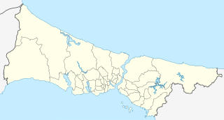
Ficheiro:Turkey Istanbul location map.svg

Ficheiro orixinal (ficheiro SVG; resolución de 1.568 × 845 píxeles; tamaño do ficheiro: 424 kB)
| Este ficheiro procede de Wikimedia Commons. A continuación móstrase a información da súa páxina de descrición. Commons é un repositorio libre de ficheiros multimedia. Pode contribuír alí cargando as súas imaxes. |
Resumo
| Descrición |
Geographische Begrenzung der Karte:
Geographic limits of the map:
|
| Data | |
| Orixe |
Obra própria, usando: File:Istanbul location districts.svg by |
| Autoría | NordNordWest |

|
Este mapa foi criado ou melhorado na Kartenwerkstatt (oficina gráfica) alemã. Você também pode propor mapas para serem melhorados.
|
Licenza
Usage of this file with:

explanatory notes: Legally binding is only the full legalcode. For a free usage I recommend to respect the following licence conditions:
1. Provide my name as given above: NordNordWest,
2. a copy of, or the URI for, the applicable license: https://creativecommons.org/licenses/by-sa/3.0/de/legalcode,
3. the title of the work,
4. in the case of an adaptation, a credit identifying the use of the work in the adaptation.
This license and the rights granted hereunder will terminate automatically upon any breach by you of the terms of this license. Any of the above conditions can be waived if you get permission from the copyright holder. If you have questions or wish differing conditions, please contact me through nnwest or my discussion page ![]() t-online.de
t-online.de
- Vostede é libre de:
- compartir – copiar, distribuír e difundir a obra
- facer obras derivadas – adaptar a obra
- Baixo as seguintes condicións:
- recoñecemento – Debe indicar a debida atribución de autoría, fornecer unha ligazón á licenza e indicar se se realizaron cambios. Pode facer isto de calquera forma razoable, mais non nunha forma que indique que quen posúe a licenza apoia ou subscribe o seu uso da obra.
- compartir igual – Se altera, transforma ou amplía este contido, debe publicar as súas contribucións baixo a mesma licenza ou outra compatible á orixinal.

Historial do ficheiro
Prema nunha data/hora para ver o ficheiro tal e como estaba nese momento.
| Data/Hora | Miniatura | Dimensións | Usuario | Comentario | |
|---|---|---|---|---|---|
| actual | 6 de abril de 2018 ás 17:26 | | 1.568 × 845 (424 kB) | NordNordWest | upd |
| 16 de agosto de 2014 ás 11:37 |  | 1.568 × 845 (465 kB) | NordNordWest | == {{int:filedesc}} == {{Information |Description= {{de|Positionskarte der Provinz Istanbul, Türkei}} Geographische Begrenzung der Karte: * N: 41.619888° N * S: 40.796666° N * W: 27.941666° O * O: 29.97388... |
Uso do ficheiro
As seguintes 2 páxinas usan este ficheiro:
Uso global do ficheiro
Os seguintes wikis empregan esta imaxe:
- Uso en ar.wikipedia.org
- Uso en azb.wikipedia.org
- Uso en az.wikipedia.org
- Ayasofiya
- Topqapı sarayı
- Əyyub Sultan məscidi
- Sultan Əhməd məscidi
- Zal Mahmud paşa məscidi
- Ulduz sarayı
- Laləli məscidi
- Yavuz Sultan Səlim külliyəsi
- Bəyazid məscidi
- İbrahim Paşa Sarayı
- Ulduz Saat Qülləsi
- Abdi İpəkçi sui-qəsdi
- Rumeli Hasarı
- Yeni məscid (İstanbul)
- Mehrimah Sultan məscidi (Üsküdar)
- Haseki hamamı
- Ağa hamamı
- Dolmabağça saat qülləsi
- Topxana saat qülləsi
- Nuruosmaniyə məscidi
- Atatürk körpüsü
- Yeddiqüllə zindanları
- İstanbul Əşkinazi sinaqoqu
- Küçüksu sarayı
- Hidiv qəsri
- Səbətçilər sarayı
- İhlamur sarayı
- Florya Atatürk Dəniz Köşkü
- Çırağan sarayı
- Şablon:Yer xəritəsi Türkiyə İstanbul
- Fateh məscidi (İstanbul)
- Kiçik Vlaxerna sarayı
- İstanbul Hava Limanı
- Lütfü Kırdar Konqres və Sərgi Sarayı (İstanbul)
- Ulduz Həmidiyyə məscidi
- Böyük İstanbul avtovağzalı
- Türkiyə Super Liqası 2021/2022
- Türkiyə Super Liqası 2020/2021
- Türkiyə Super Liqası 2019/2020
- Türkiyə Super Liqası 2018/2019
- Uso en bn.wikipedia.org
Ollar o uso global deste ficheiro.