Ficheiro:Toki city center area Aerial photograph.1987.jpg

Tamaño desta vista previa: 750 × 600 píxeles. Outras resolucións: 300 × 240 píxeles | 601 × 480 píxeles | 961 × 768 píxeles | 1.280 × 1.023 píxeles | 2.560 × 2.047 píxeles | 7.055 × 5.640 píxeles.
Ficheiro orixinal (7.055 × 5.640 píxeles; tamaño do ficheiro: 32,17 MB; tipo MIME: image/jpeg)
| Este ficheiro procede de Wikimedia Commons. A continuación móstrase a información da súa páxina de descrición. Commons é un repositorio libre de ficheiros multimedia. Pode contribuír alí cargando as súas imaxes. |
Resumo
| Descrición |
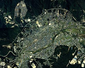
English: Toki city center area Aerial photograph.1987
日本語: 土岐市(岐阜県)中心部周辺の空中写真。ccb-87-1_c10の62,63,64,65、ccb-87-1_c11aの61,62,63,64、合計8枚を合成作成。 |
| Data | |
| Orixe | 国土情報ウェブマッピングシステム |
| Autoría | 国土交通省 |
Licenza

|
O propietario dos dereitos de autor deste ficheiro, the Ministry of Land, Infrastructure, Transport and Tourism of Japan, permite que calquera poida usalo para calquera propósito, sempre e cando se lle recoñeza a autoría a quen cede os dereitos. A redistribución, edición, uso comercial e calquera outro tipo de uso están permitidos. |
Recoñecemento:
Copyright © National Land Image Information (Color Aerial Photographs), Ministry of Land, Infrastructure, Transport and Tourism
|
 |
This image is copyrighted by the Ministry of Land, Infrastructure, Transport and Tourism of Japan. For terms of use, see the stipulation to use of National Land Information (in Japanese) and message from MLIT (in Japanese and English). When you display this image on an article, include the following phrase in the description: "Made based on National Land Image Information (Color Aerial Photographs), Ministry of Land, Infrastructure, Transport and Tourism".
|
Historial do ficheiro
Prema nunha data/hora para ver o ficheiro tal e como estaba nese momento.
| Data/Hora | Miniatura | Dimensións | Usuario | Comentario | |
|---|---|---|---|---|---|
| actual | 13 de febreiro de 2014 ás 12:28 | | 7.055 × 5.640 (32,17 MB) | さかおり | {{Information |Description ={{en|1=Toki city center area Aerial photograph.1987}} {{ja|1=土岐市(岐阜県)中心部周辺の空中写真。ccb-87-1_c10の62,63,64,65、ccb-87-1_c11aの61,62,63,64、合計8枚を合成作成。}} |Source... |
Uso do ficheiro
A seguinte páxina usa este ficheiro:
Uso global do ficheiro
Os seguintes wikis empregan esta imaxe:
- Uso en ar.wikipedia.org
- Uso en ceb.wikipedia.org
- Uso en ce.wikipedia.org
- Uso en en.wikivoyage.org
- Uso en eu.wikipedia.org
- Uso en fi.wikipedia.org
- Uso en fr.wikivoyage.org
- Uso en it.wikipedia.org
- Uso en ja.wikipedia.org
- Uso en mzn.wikipedia.org
- Uso en pt.wikipedia.org
- Uso en ro.wikipedia.org
- Uso en tt.wikipedia.org
- Uso en vi.wikipedia.org
- Uso en www.wikidata.org