Ficheiro:Saint Vincent OnEarth WMS.png

Tamaño desta vista previa: 600 × 600 píxeles. Outras resolucións: 240 × 240 píxeles | 480 × 480 píxeles | 768 × 768 píxeles | 1.215 × 1.215 píxeles.
Ficheiro orixinal (1.215 × 1.215 píxeles; tamaño do ficheiro: 2,22 MB; tipo MIME: image/png)
| Este ficheiro procede de Wikimedia Commons. A continuación móstrase a información da súa páxina de descrición. Commons é un repositorio libre de ficheiros multimedia. Pode contribuír alí cargando as súas imaxes. |
| Descrición |
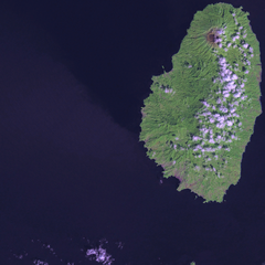
Satellite image of Saint Vincent Screenshot from NASA World Wind, OnEarth WMS global mosaic pseudocolor layer. |
| Data | (UTC) |
| Orixe | |
| Autoría |
|
| Esta é unha imaxe retocada,en o que significa que a súa versión orixinal foi alterada dixitalmente. Modificacións: resizing for focus. A orixinal pódese ver aquí: Saint Vincent and the Grenadines OnEarth WMS.png. As modificacións realizounas Xfigpower.
|
| This image is in the public domain because it is a screenshot from NASA’s globe software World Wind using a public domain layer, such as Blue Marble, MODIS, Landsat, SRTM, USGS or GLOBE.
|
 |
Rexistro de cargas orixinal
This image is a derivative work of the following images:
- File:Saint_Vincent_and_the_Grenadines_OnEarth_WMS.png licensed with PD-WorldWind
- 2006-04-29T20:36:20Z Hautala 1215x2869 (4062405 Bytes) {{PD-WorldWind}} Satellite image of Saint Vincent and the Grenadines. Screenshot from NASA World Wind, OnEarth WMS layer. [[Category:Satellite images of countries]]
Carregada com derivativeFX
Historial do ficheiro
Prema nunha data/hora para ver o ficheiro tal e como estaba nese momento.
| Data/Hora | Miniatura | Dimensións | Usuario | Comentario | |
|---|---|---|---|---|---|
| actual | 19 de xaneiro de 2009 ás 16:47 | | 1.215 × 1.215 (2,22 MB) | Xfigpower | {{Information |Description=Satellite image of Saint Vincent Screenshot from NASA World Wind, OnEarth WMS global mosaic pseudocolor layer. |Source=*File:Saint_Vincent_and_the_Grenadines_OnEarth_WMS.png |Date=2009-01-19 16:46 (UTC) |Author=*derivative |
Uso do ficheiro
A seguinte páxina usa este ficheiro:
Uso global do ficheiro
Os seguintes wikis empregan esta imaxe:
- Uso en ar.wikipedia.org
- Uso en az.wikipedia.org
- Uso en be.wikipedia.org
- Uso en br.wikipedia.org
- Uso en ca.wikipedia.org
- Uso en da.wikipedia.org
- Uso en de.wikivoyage.org
- Uso en es.wikipedia.org
- Uso en fi.wikipedia.org
- Uso en fi.wiktionary.org
- Uso en frr.wikipedia.org
- Uso en fr.wikipedia.org
- Uso en he.wikipedia.org
- Uso en ja.wikipedia.org
- Uso en lb.wikipedia.org
- Uso en lt.wikipedia.org
- Uso en pap.wikipedia.org
- Uso en tr.wikipedia.org
- Uso en ur.wikipedia.org
- Uso en www.wikidata.org