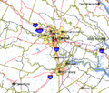
Ficheiro:Richmond-Petersburg TIGER MAP.gif
Richmond-Petersburg_TIGER_MAP.gif (422 × 359 píxeles; tamaño do ficheiro: 18 kB; tipo MIME: image/gif)
Historial do ficheiro
Prema nunha data/hora para ver o ficheiro tal e como estaba nese momento.
| Data/Hora | Miniatura | Dimensións | Usuario | Comentario | |
|---|---|---|---|---|---|
| actual | 26 de abril de 2007 ás 23:13 |  | 422 × 359 (18 kB) | Sitomon | {{Information |Description=richmond área metropolitana |Source=http://en.wikipedia.org/wiki/Image:Richmond-Petersburg_TIGER_MAP.gif |Date=14/02/06 |Author=gobierno USA }} |
Uso do ficheiro
A seguinte páxina usa este ficheiro:
Uso global do ficheiro
Os seguintes wikis empregan esta imaxe:
- Uso en en.wikipedia.org
- Uso en es.wikipedia.org
- Uso en it.wikipedia.org
- Uso en www.wikidata.org

