Ficheiro:Rhodes NLT Landsat7.png
Tamaño desta vista previa: 605 × 600 píxeles. Outras resolucións: 242 × 240 píxeles | 484 × 480 píxeles | 775 × 768 píxeles | 1.033 × 1.024 píxeles | 1.948 × 1.931 píxeles.
Ficheiro orixinal (1.948 × 1.931 píxeles; tamaño do ficheiro: 5,65 MB; tipo MIME: image/png)
| Este ficheiro procede de Wikimedia Commons. A continuación móstrase a información da súa páxina de descrición. Commons é un repositorio libre de ficheiros multimedia. Pode contribuír alí cargando as súas imaxes. |
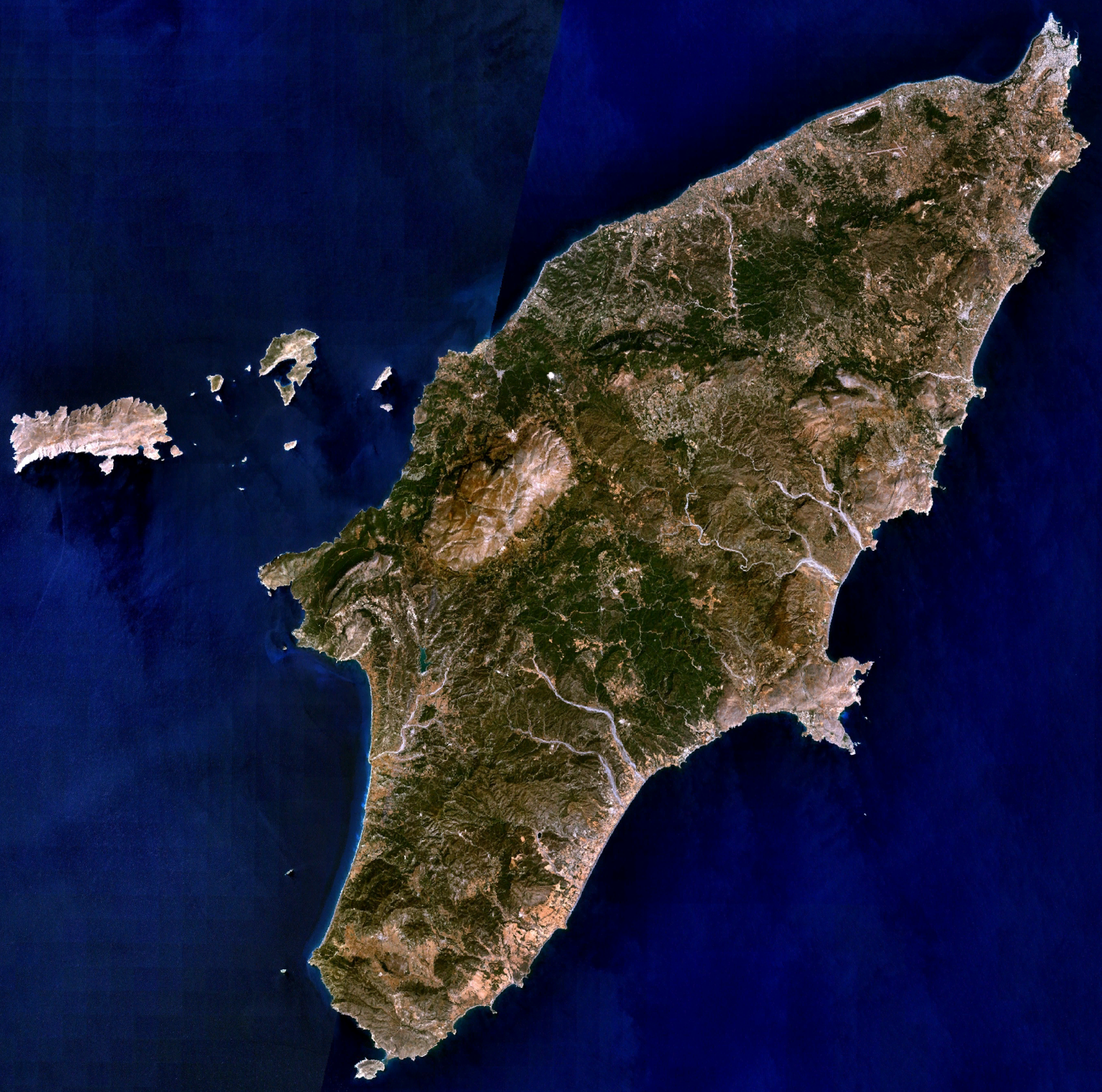
| Descrición | Visible colour satellite image of Rhodes. | |||
| Orixe |
Screenshot from NASA World Wind, NLT Landsat7 layer. Coordinates: worldwind://goto/world=Earth&lat=36.16654&lon=27.93315&alt=80698 |
|||
| Autoría | Fotografía: NASA | |||
| Licenza (Reuso deste ficheiro) |
|
|||
| Outras versións | Image:Rodas.png |

Historial do ficheiro
Prema nunha data/hora para ver o ficheiro tal e como estaba nese momento.
| Data/Hora | Miniatura | Dimensións | Usuario | Comentario | |
|---|---|---|---|---|---|
| actual | 16 de abril de 2006 ás 20:29 | | 1.948 × 1.931 (5,65 MB) | Hautala | {{Information| |Description=Visible colour satellite image of Rhodes. |Source=Screenshot from NASA World Wind, NLT Landsat7 layer. |Date= |Author= |Permission={{PD-WorldWind}} |other_versions= }} |
Uso do ficheiro
Non hai páxinas que usen este ficheiro.
Uso global do ficheiro
Os seguintes wikis empregan esta imaxe:
- Uso en ab.wikipedia.org
- Uso en als.wikipedia.org
- Uso en an.wikipedia.org
- Uso en ar.wikipedia.org
- Uso en az.wikipedia.org
- Uso en be-tarask.wikipedia.org
- Uso en be.wikipedia.org
- Uso en bg.wikipedia.org
- Uso en ca.wikipedia.org
- Uso en ceb.wikipedia.org
- Uso en cs.wikipedia.org
- Uso en da.wikipedia.org
- Uso en de.wikipedia.org
- Uso en el.wikipedia.org
- Uso en en.wikipedia.org
- Uso en eu.wikipedia.org
- Uso en fi.wikipedia.org
- Uso en fr.wikipedia.org
Ollar o uso global deste ficheiro.