Ficheiro:Pennines edited-1.jpg
Tamaño desta vista previa: 697 × 600 píxeles. Outras resolucións: 279 × 240 píxeles | 558 × 480 píxeles | 824 × 709 píxeles.
Ficheiro orixinal (824 × 709 píxeles; tamaño do ficheiro: 57 kB; tipo MIME: image/jpeg)
| Este ficheiro procede de Wikimedia Commons. A continuación móstrase a información da súa páxina de descrición. Commons é un repositorio libre de ficheiros multimedia. Pode contribuír alí cargando as súas imaxes. |
Resumo
| Descrición |
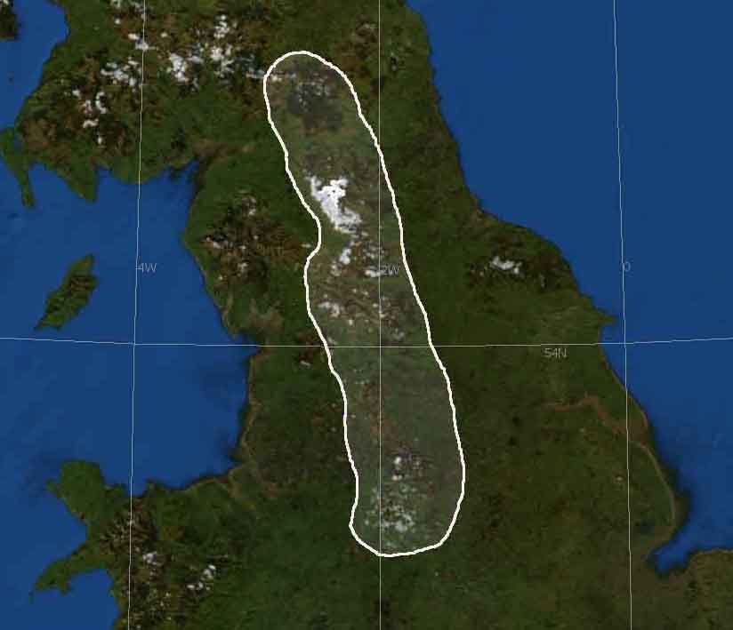
English: Base image from NASA World Wind
Edited by en:User:Harkey Lodger to show Pennines region of UK December 02 2007 |
| Orixe | Satellite imagery taken from NASA World Wind software (by screenshot) |
| Autoría | Fotografía: NASA |
Licenza
| This image is in the public domain because it is a screenshot from NASA’s globe software World Wind using a public domain layer, such as Blue Marble, MODIS, Landsat, SRTM, USGS or GLOBE.
|
 |
Rexistro de cargas orixinal
A páxina orixinal de descrición está aquí. Tódolos seguintes nomes de usuario refírense a en.wikipedia.
- 2007-12-02 15:46 Harkey Lodger 824×709×8 (58612 bytes) {{ImageSummary}} Base image from NASA World Wind
Historial do ficheiro
Prema nunha data/hora para ver o ficheiro tal e como estaba nese momento.
| Data/Hora | Miniatura | Dimensións | Usuario | Comentario | |
|---|---|---|---|---|---|
| actual | 23 de xuño de 2008 ás 10:55 | | 824 × 709 (57 kB) | Powerek38 | {{Information |Description={{en|Base image from NASA World Wind Edited by en:User:Harkey Lodger to show Pennines region of UK December 02 2007}} |Source=Transferred from [http://en.wikipedia.org en.wikipedia] |Date=2007-12-02 (original upload date) | |
Uso do ficheiro
A seguinte páxina usa este ficheiro:
Uso global do ficheiro
Os seguintes wikis empregan esta imaxe:
- Uso en ast.wikipedia.org
- Uso en be.wikipedia.org
- Uso en br.wikipedia.org
- Uso en cy.wikipedia.org
- Uso en en.wikipedia.org
- Uso en eo.wikipedia.org
- Uso en es.wikipedia.org
- Uso en fy.wikipedia.org
- Uso en hu.wikipedia.org
- Uso en hy.wikipedia.org
- Uso en id.wikipedia.org
- Uso en is.wikipedia.org
- Uso en it.wikipedia.org
- Uso en it.wikibooks.org
- Uso en ja.wikipedia.org
- Uso en kk.wikipedia.org
- Uso en ko.wikipedia.org
- Uso en kw.wikipedia.org
- Uso en ky.wikipedia.org
- Uso en nn.wikipedia.org
- Uso en no.wikipedia.org
- Uso en pl.wikipedia.org
- Uso en pl.wiktionary.org
- Uso en ru.wikipedia.org
- Uso en ta.wikipedia.org
- Uso en uk.wikipedia.org
- Uso en zh.wikipedia.org