Ficheiro:Nasa world wind - teneriffa.jpg

Tamaño desta vista previa: 800 × 599 píxeles. Outras resolucións: 320 × 240 píxeles | 640 × 479 píxeles | 1.024 × 766 píxeles | 1.280 × 958 píxeles.
Ficheiro orixinal (1.280 × 958 píxeles; tamaño do ficheiro: 120 kB; tipo MIME: image/jpeg)
Historial do ficheiro
Prema nunha data/hora para ver o ficheiro tal e como estaba nese momento.
| Data/Hora | Miniatura | Dimensións | Usuario | Comentario | |
|---|---|---|---|---|---|
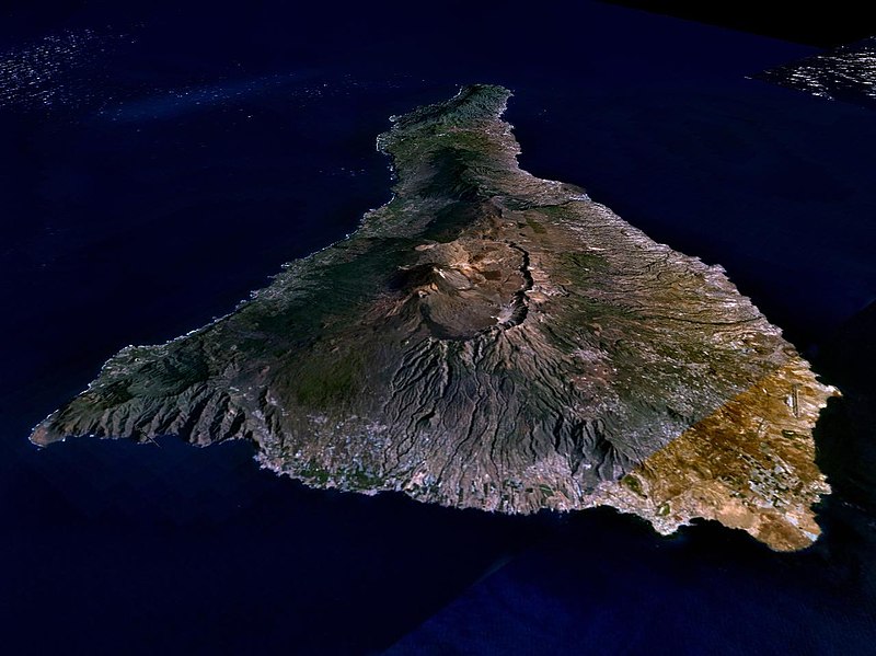
| actual | 31 de marzo de 2005 ás 01:15 |  | 1.280 × 958 (120 kB) | Simplicius | {{NASA-PD}} Teneriffa from the west side. One sees Teide (3,700 meters) and the Caldera (2,000 m). To the right hand the new airport. On the left side one sees that there is more humidity and therefore vegetation at the north side of the island. |
Uso do ficheiro
A seguinte páxina usa este ficheiro:
Uso global do ficheiro
Os seguintes wikis empregan esta imaxe:
- Uso en ar.wikipedia.org
- Uso en be-tarask.wikipedia.org
- Uso en cs.wikipedia.org
- Uso en de.wikipedia.org
- Uso en de.wikinews.org
- Uso en de.wikivoyage.org
- Uso en en.wiktionary.org
- Uso en eo.wikipedia.org
- Uso en es.wikipedia.org
- Uso en fa.wikipedia.org
- Uso en fi.wikipedia.org
- Uso en frr.wikipedia.org
- Uso en fy.wikipedia.org
- Uso en he.wikipedia.org
- Uso en hu.wikipedia.org
- Uso en incubator.wikimedia.org
- Uso en it.wikipedia.org
- Uso en mn.wikipedia.org
- Uso en nn.wikipedia.org
- Uso en no.wikipedia.org
- Uso en pl.wiktionary.org
- Uso en ru.wikipedia.org
- Uso en sh.wikipedia.org
- Uso en sk.wikipedia.org
- Uso en sw.wikipedia.org
- Uso en tr.wikipedia.org
- Uso en uk.wikipedia.org
- Uso en vi.wikivoyage.org
- Uso en zgh.wikipedia.org
