Ficheiro:Map helgoland 1910.jpg

Ficheiro orixinal (603 × 769 píxeles; tamaño do ficheiro: 344 kB; tipo MIME: image/jpeg)
| Este ficheiro procede de Wikimedia Commons. A continuación móstrase a información da súa páxina de descrición. Commons é un repositorio libre de ficheiros multimedia. Pode contribuír alí cargando as súas imaxes. |
Resumo
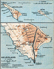
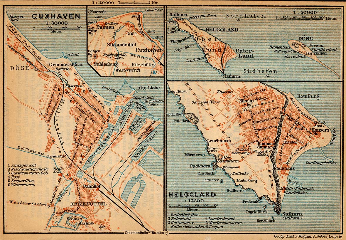
| Descrición | Map of Heligoland, Germany, 1910 |
| Data | |
| Orixe | http://www.lib.utexas.edu/maps/historical/baedeker_n_germany_1910/cuxhaven_helgoland_1910.jpg |
| Autoría | "Northern Germany as far as the Bavarian and Austrian Frontiers; Handbook for Travellers" by Karl Baedeker. Fifteenth Revised Edition. Leipzig, Karl Baedeker; New York, Charles Scribner's Sons 1910. |
| Licenza (Reuso deste ficheiro) |
"Courtesy of the University of Texas Libraries, The University of Texas at Austin." http://www.lib.utexas.edu/maps/map_sites/hist_sites.html |
| Outras versións |
Obras derivadas deste ficheiro: Map helgoland 1910 cropped.jpg cut from Image:Map cuxhaven helgoland 1910.jpg |
Licenza
|
Este material está no dominio público nos demais países onde os dereitos de autor se estenden por 70 anos (ou menos) trala morte do autor.
| |
| Este ficheiro foi identificado como libre de restricións baixo as leis de dereitos de autor, incluídos todos os dereitos relacionados. | |
Historial do ficheiro
Prema nunha data/hora para ver o ficheiro tal e como estaba nese momento.
| Data/Hora | Miniatura | Dimensións | Usuario | Comentario | |
|---|---|---|---|---|---|
| actual | 23 de abril de 2006 ás 17:28 | | 603 × 769 (344 kB) | 700 MB | {{Information| |Description=Map of Heligoland, Germany, 1910 |Source=http://www.lib.utexas.edu/maps/historical/baedeker_n_germany_1910/cuxhaven_helgoland_1910.jpg |Date=1910 |Author="Northern Germany as far as the Bavarian and Austrian Frontiers; Handbo |
Uso do ficheiro
A seguinte páxina usa este ficheiro:
Uso global do ficheiro
Os seguintes wikis empregan esta imaxe:
- Uso en cs.wikipedia.org
- Uso en en.wikipedia.org
- Uso en en.wikiversity.org
- Uso en eu.wikipedia.org
- Uso en fy.wikipedia.org
- Uso en ja.wikipedia.org
- Uso en mk.wikipedia.org
- Uso en nl.wikipedia.org
- Uso en nn.wikipedia.org
- Uso en pl.wikipedia.org
- Uso en uk.wikipedia.org
- Uso en vi.wikipedia.org
- Uso en yi.wikipedia.org
- Uso en zh.wikipedia.org