Ficheiro:Map Chacachacare 2.jpg

Tamaño desta vista previa: 800 × 514 píxeles. Outras resolucións: 320 × 206 píxeles | 640 × 411 píxeles | 957 × 615 píxeles.
Ficheiro orixinal (957 × 615 píxeles; tamaño do ficheiro: 97 kB; tipo MIME: image/jpeg)
| Este ficheiro procede de Wikimedia Commons. A continuación móstrase a información da súa páxina de descrición. Commons é un repositorio libre de ficheiros multimedia. Pode contribuír alí cargando as súas imaxes. |
Resumo
| Descrición |
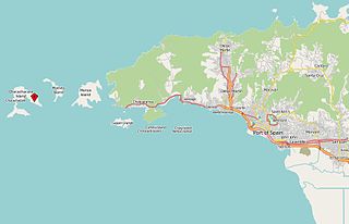
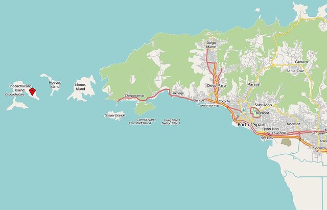
English: Position of Chacachacare Island in the northwest of Trinidad. |
| Data | |
| Orixe | http://openstreetmap.org |
| Autoría | http://openstreetmap.org |
Licenza
| This work contains information from OpenStreetMap, which is made available under the Open Database License (ODbL).
The ODbL does not require any particular license for maps produced from ODbL data. Prior to 1 August 2020, map tiles produced by the OpenStreetMap Foundation were licensed under the CC-BY-SA-2.0 license. Maps produced by other people may be subject to other licences. |
Historial do ficheiro
Prema nunha data/hora para ver o ficheiro tal e como estaba nese momento.
| Data/Hora | Miniatura | Dimensións | Usuario | Comentario | |
|---|---|---|---|---|---|
| actual | 12 de decembro de 2013 ás 09:55 | | 957 × 615 (97 kB) | Grueslayer | User created page with UploadWizard |
Uso do ficheiro
A seguinte páxina usa este ficheiro:
Uso global do ficheiro
Os seguintes wikis empregan esta imaxe:
- Uso en de.wikipedia.org
- Uso en pt.wikipedia.org
- Uso en vep.wikipedia.org