Ficheiro:Karte Römische Städte in Nordafrika.svg

Ficheiro orixinal (ficheiro SVG; resolución de 1.011 × 336 píxeles; tamaño do ficheiro: 821 kB)
| Este ficheiro procede de Wikimedia Commons. A continuación móstrase a información da súa páxina de descrición. Commons é un repositorio libre de ficheiros multimedia. Pode contribuír alí cargando as súas imaxes. |
Resumo
| Descrición |
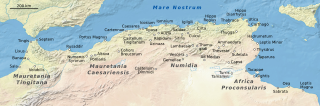
Deutsch: Karte der römischen Städte in Nordafrika |
| Data | |
| Orixe |
|
| Autoría | NordNordWest |

|
Este mapa foi criado ou melhorado na Kartenwerkstatt (oficina gráfica) alemã. Você também pode propor mapas para serem melhorados.
|
Licenza
Usage of this file with:

explanatory notes: Legally binding is only the full legalcode. For a free usage I recommend to respect the following licence conditions:
1. Provide my name as given above: NordNordWest,
2. a copy of, or the URI for, the applicable license: https://creativecommons.org/licenses/by-sa/3.0/de/legalcode,
3. the title of the work,
4. in the case of an adaptation, a credit identifying the use of the work in the adaptation.
This license and the rights granted hereunder will terminate automatically upon any breach by you of the terms of this license. Any of the above conditions can be waived if you get permission from the copyright holder. If you have questions or wish differing conditions, please contact me through nnwest or my discussion page ![]() t-online.de
t-online.de
- Vostede é libre de:
- compartir – copiar, distribuír e difundir a obra
- facer obras derivadas – adaptar a obra
- Baixo as seguintes condicións:
- recoñecemento – Debe indicar a debida atribución de autoría, fornecer unha ligazón á licenza e indicar se se realizaron cambios. Pode facer isto de calquera forma razoable, mais non nunha forma que indique que quen posúe a licenza apoia ou subscribe o seu uso da obra.
- compartir igual – Se altera, transforma ou amplía este contido, debe publicar as súas contribucións baixo a mesma licenza ou outra compatible á orixinal.

Historial do ficheiro
Prema nunha data/hora para ver o ficheiro tal e como estaba nese momento.
| Data/Hora | Miniatura | Dimensións | Usuario | Comentario | |
|---|---|---|---|---|---|
| actual | 16 de maio de 2022 ás 17:43 | 1.011 × 336 (821 kB) | NordNordWest | == {{int:filedesc}} == {{Information |description= {{de|1=Karte der römischen Städte in Nordafrika}} |source= * Putzger Historischer Atlas, Cornelsen Verlag, Berlin, 2001 * [http://www.shadedrelief.com/natural/pages/download.html Natural Earth, Tom Patterson, US National Park Service] |date={{Date|2022|05|16}} |author={{U|NordNordWest}} |permission= |other_versions= }} {{Kartenwerkstatt}} == {{int:license-header}} == {{User:NordNordWest/LicenceMap}} Category:Maps of Roman provinces [[Ca... |
Uso do ficheiro
A seguinte páxina usa este ficheiro:
Uso global do ficheiro
Os seguintes wikis empregan esta imaxe:
- Uso en ar.wikipedia.org
- Uso en ast.wikipedia.org
- Uso en de.wikipedia.org
- Uso en en.wikipedia.org
- Uso en es.wikipedia.org
- Uso en et.wikipedia.org
- Uso en fr.wikipedia.org
Ollar o uso global deste ficheiro.