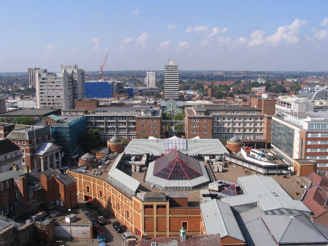
Ficheiro:Broadgate and Precincts - geograph.org.uk - 554599.jpg
Broadgate_and_Precincts_-_geograph.org.uk_-_554599.jpg (640 × 480 píxeles; tamaño do ficheiro: 96 kB; tipo MIME: image/jpeg)
Historial do ficheiro
Prema nunha data/hora para ver o ficheiro tal e como estaba nese momento.
| Data/Hora | Miniatura | Dimensións | Usuario | Comentario | |
|---|---|---|---|---|---|
| actual | 6 de febreiro de 2011 ás 02:26 |  | 640 × 480 (96 kB) | GeographBot | == {{int:filedesc}} == {{Information |description={{en|1=Broadgate and Precincts Taken from the tower of the old cathedral church of St. Michael, looking westwards down the line of the Upper and Lower Precinct shopping areas towards Mercia House[1], the t |
Uso do ficheiro
A seguinte páxina usa este ficheiro:
Uso global do ficheiro
Os seguintes wikis empregan esta imaxe:
- Uso en af.wikipedia.org
- Uso en an.wikipedia.org
- Uso en ar.wikipedia.org
- Uso en arz.wikipedia.org
- Uso en ast.wikipedia.org
- Uso en azb.wikipedia.org
- Uso en az.wikipedia.org
- Uso en be-tarask.wikipedia.org
- Uso en be.wikipedia.org
- Uso en ca.wikipedia.org
- Uso en ceb.wikipedia.org
- Uso en cs.wikipedia.org
- Uso en cy.wikipedia.org
- Uso en da.wikipedia.org
- Uso en de.wikipedia.org
- Uso en de.wikivoyage.org
- Uso en diq.wikipedia.org
- Uso en el.wikipedia.org
- Uso en en.wikipedia.org
- Uso en en.wikivoyage.org
- Uso en eo.wikipedia.org
- Uso en es.wikipedia.org
- Uso en eu.wikipedia.org
- Uso en frr.wikipedia.org
- Uso en fr.wikipedia.org
- Uso en fr.wikivoyage.org
- Uso en fy.wikipedia.org
- Uso en ga.wikipedia.org
- Uso en he.wikivoyage.org
- Uso en hy.wikipedia.org
- Uso en ku.wikipedia.org
- Uso en lld.wikipedia.org
- Uso en lv.wikipedia.org
- Uso en mdf.wikipedia.org
- Uso en mzn.wikipedia.org
- Uso en nn.wikipedia.org
- Uso en no.wikipedia.org
- Uso en os.wikipedia.org
- Uso en pl.wikipedia.org
- Uso en pl.wikivoyage.org
- Uso en pnb.wikipedia.org
- Uso en ro.wikipedia.org
- Uso en ru.wikinews.org
- Uso en sco.wikipedia.org
Ollar o uso global deste ficheiro.

