Ficheiro:SatDenmarkAmt.jpg
Tamaño desta vista previa: 785 × 600 píxeles. Outras resolucións: 314 × 240 píxeles | 628 × 480 píxeles | 1.005 × 768 píxeles | 1.280 × 978 píxeles.
Ficheiro orixinal (1.280 × 978 píxeles; tamaño do ficheiro: 374 kB; tipo MIME: image/jpeg)
| Este ficheiro procede de Wikimedia Commons. A continuación móstrase a información da súa páxina de descrición. Commons é un repositorio libre de ficheiros multimedia. Pode contribuír alí cargando as súas imaxes. |
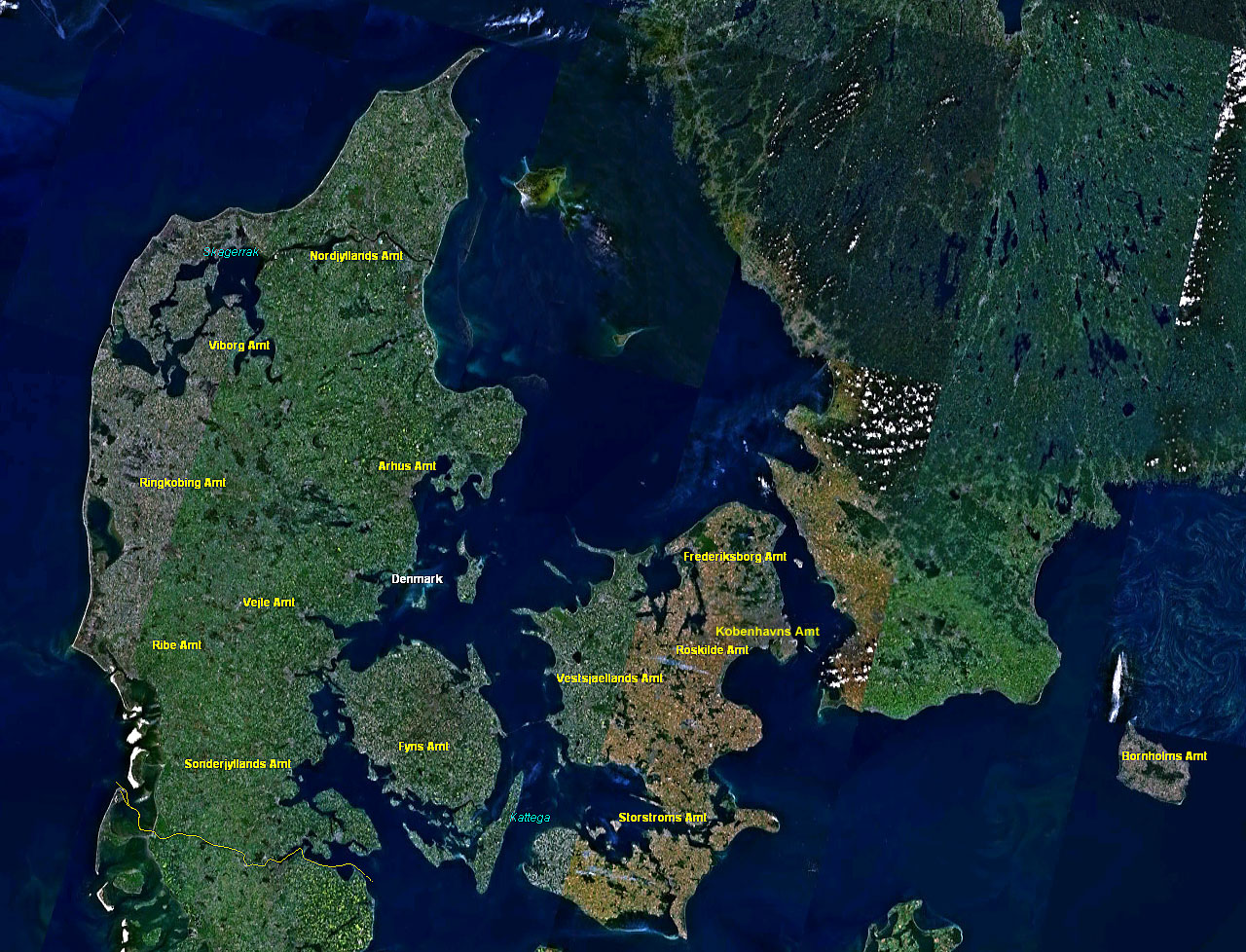
Resumo
Español: Imagén Satelital de Dinamarca mostrando la división del territorio en Amter
- Satellitenaufnahme Dänemark mit Amtbezeichnungen
- from Nasa World Wind - Free Satellite Image
| This image is in the public domain because it is a screenshot from NASA’s globe software World Wind using a public domain layer, such as Blue Marble, MODIS, Landsat, SRTM, USGS or GLOBE.
|
 |
Historial do ficheiro
Prema nunha data/hora para ver o ficheiro tal e como estaba nese momento.
| Data/Hora | Miniatura | Dimensións | Usuario | Comentario | |
|---|---|---|---|---|---|
| actual | 19 de xaneiro de 2006 ás 17:30 | | 1.280 × 978 (374 kB) | Godewind | * Satellitenaufnahme Dänemark mit Amtbezeichnungen * from Nasa World Wind - Free Satellite Image {{PD-USGov}} Category:Satellite photos Category:Satellite images of the islands Category:Denmark |
Uso do ficheiro
A seguinte páxina usa este ficheiro:
Uso global do ficheiro
Os seguintes wikis empregan esta imaxe:
- Uso en da.wikipedia.org
- Uso en de.wikipedia.org