Ficheiro:Butaritari Map.jpg

Ficheiro orixinal (7.864 × 6.982 píxeles; tamaño do ficheiro: 1,32 MB; tipo MIME: image/jpeg)
| Este ficheiro procede de Wikimedia Commons. A continuación móstrase a información da súa páxina de descrición. Commons é un repositorio libre de ficheiros multimedia. Pode contribuír alí cargando as súas imaxes. |
| Aviso | Algúns navegadores poden ter problemas mostrando esta imaxe na súa máxima resolución. Isto ocorre porque a imaxe ten un gran número de píxeles e poida que non cargue completamente ou provoque que o navegador deixe de funcionar momentaneamente. |
|---|
Resumo
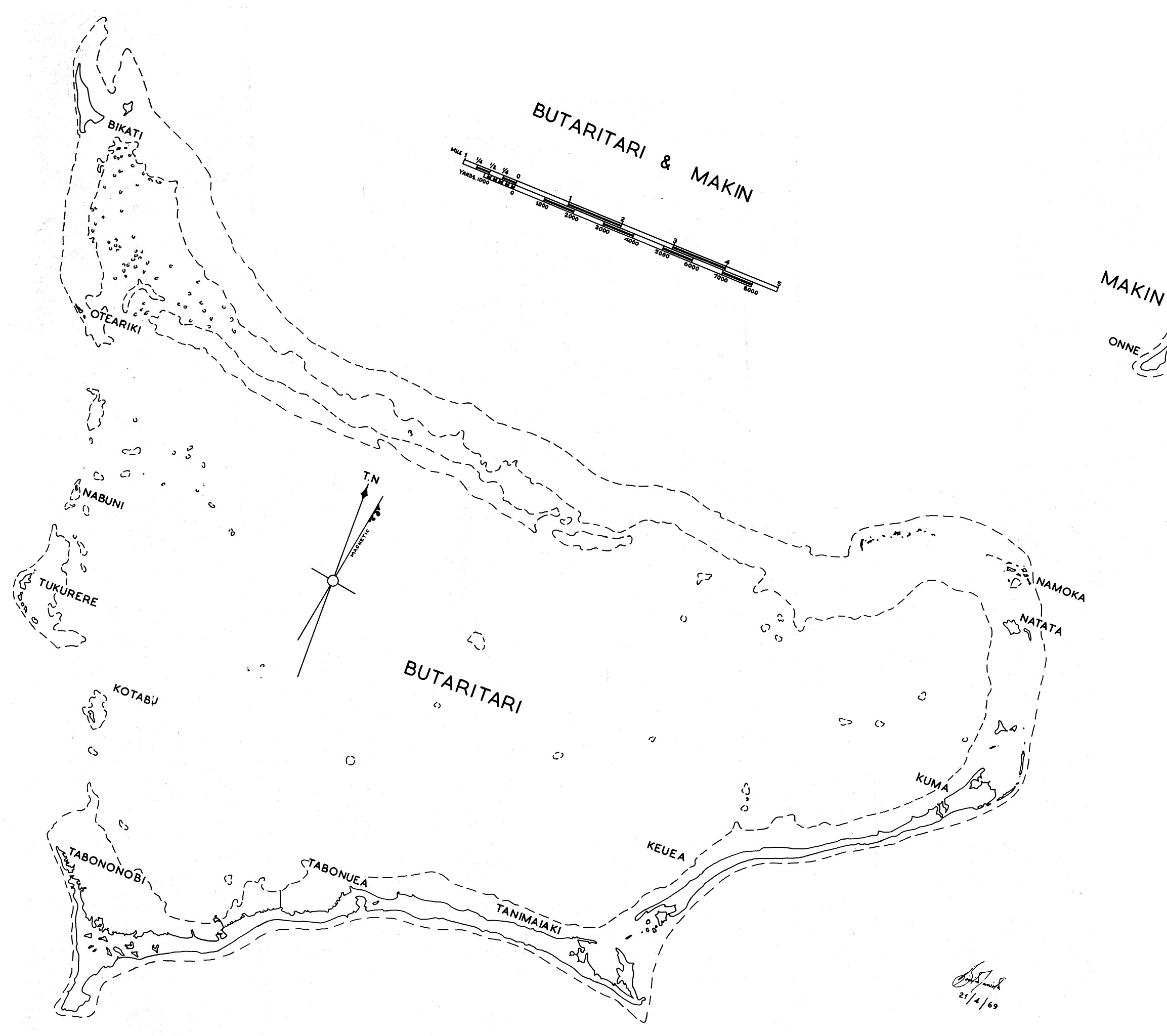
Government map (some maps in the series include the following: "Compiled by Lands and Surveys, Betio, Tarawa") with inscription "[signature 21/4/1969". Original obtained either directly from GEIDA of from a U.S. Government source (USACOE) as a blueline printing sometime in the 1970s. I believe these maps were produced for government use by the Gilbert Islands Colony. I have scanned and slightly altered the original (1/50,000 scale). Makin portion was partly lost in storage. Orientation as printed. - Marshman 01:22, 29 November 2005 (UTC)
Licenza
Esta obra atópase no dominio público nos Estados Unidos de América porque é unha obra feita por un funcionario/a ou empregado/a do goberno federal dos Estados Unidos de América como parte das funcións oficiais desa persoa (en español) baixo os termos do Título 17, Capítulo 1, Sección 105 do Código dos EUA. Véxase o artigo "Dereitos de autoría".(en inglés)
Nota: Isto é válido para as obras orixinais do goberno federal e non para as obras individuais de calquera estado, territorio (en inglés), condado, municipio ou calquera outra subdivisión dos EUA. Este modelo tampouco é válido para os deseños dos selos postais publicados polo Servizo Postal dos Estados Unidos desde 1978. (Véxase o 206.02(b) of Compendium II: Copyright Office Practices.) Tampouco é válido para certas moedas dos EUA; véxanse os termos de uso da Casa da Moeda dos Estados Unidos de América.
|
 | |
| Este ficheiro foi identificado como libre de restricións baixo as leis de dereitos de autor, incluídos todos os dereitos relacionados. | ||
Historial do ficheiro
Prema nunha data/hora para ver o ficheiro tal e como estaba nese momento.
| Data/Hora | Miniatura | Dimensións | Usuario | Comentario | |
|---|---|---|---|---|---|
| actual | 29 de novembro de 2005 ás 01:19 | | 7.864 × 6.982 (1,32 MB) | Marshman~commonswiki | Same as previous Kiribati maps |
Uso do ficheiro
A seguinte páxina usa este ficheiro:
Uso global do ficheiro
Os seguintes wikis empregan esta imaxe:
- Uso en de.wikipedia.org
- Uso en el.wikipedia.org
- Uso en en.wikipedia.org
- Uso en he.wikipedia.org
- Uso en hu.wikipedia.org
- Uso en ja.wikipedia.org
- Uso en mk.wikipedia.org
- Uso en pl.wikipedia.org
- Uso en ru.wikipedia.org
- Uso en www.wikidata.org